
玉带滩 Yù dài tān, the Jade Belt Shoal, is a sand spit two and a half kilometres long that lies across the mouth of the 万泉河 Wàn quán hé at 博鳌镇 Bó’áo zhèn in 琼海市 Qiónghǎi shì, and what makes it remarkable is simply that it is thin. The spit runs roughly north to south and it separates two bodies of water that are not the same thing at all: on its western side the combined outflow of three rivers – the 万泉河, the 龙滚河 Lóng gǔn hé and the 九曲江 Jiǔ qū jiāng – and on its eastern side the open 南海 Nán hǎi. It is about three hundred metres wide at its widest, and at high tide the narrowest part is barely ten metres across, which is a causeway built by nothing but wave and current.
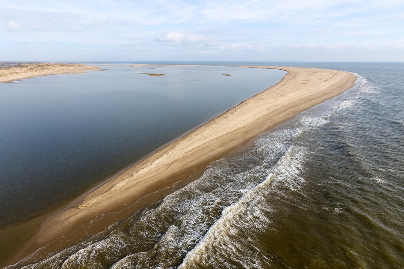
That geometry is what was recognised in June 1999, when the Shanghai Great World Guinness organisation in China – the body that then held the Guinness franchise here – certified the shoal as the narrowest sand spit separating a sea from a river anywhere, and recorded it as a 吉尼斯之最. It has been one ever since, and the record is not a gimmick: a sand ridge can hold a channel only because there is something solid under it, and samples show the spit is laid on a rock base rather than on mobile mud. The two sides behave differently for the same reason. The eastern face, towards the sea, is coarse sand mixed with shell fragments and stands in ordinary salt water; the western face, towards the rivers, is fine soft sand in water whose salinity has been measured at around three parts in a thousand, which is fresh water by any definition. Stand in the middle and you are on a wall a few metres wide between a salt sea and a fresh river, both of them moving.
The shoal also moves. The mouth of the 万泉河 has shifted north or south every few years for as long as anyone has been writing about it, by as much as several tens of metres in the largest movements, because the sand the current drops and the waves take away do not balance. A county gazetteer dating from the Ming dynasty already describes it, in a passage that says the sea tide runs hard, the sand chokes and narrows the passage, that it opens north or south without rule, and that boatmen who do not know the channel are drowned – which is a fair description of a river mouth on a monsoon coast and a reminder that the spit is the sediment the river could not carry rather than a permanent feature. The three islands that the rivers come in around, 东屿岛 Dōng yǔ dǎo, 鸳鸯岛 Yuān yāng dǎo and 沙坡岛 Shā pō dǎo, and the three low hills behind them, make the whole arrangement unusual enough that it is often described as the best-preserved river mouth landscape of its kind in the world, and the shoal is the piece of it that everyone photographs.
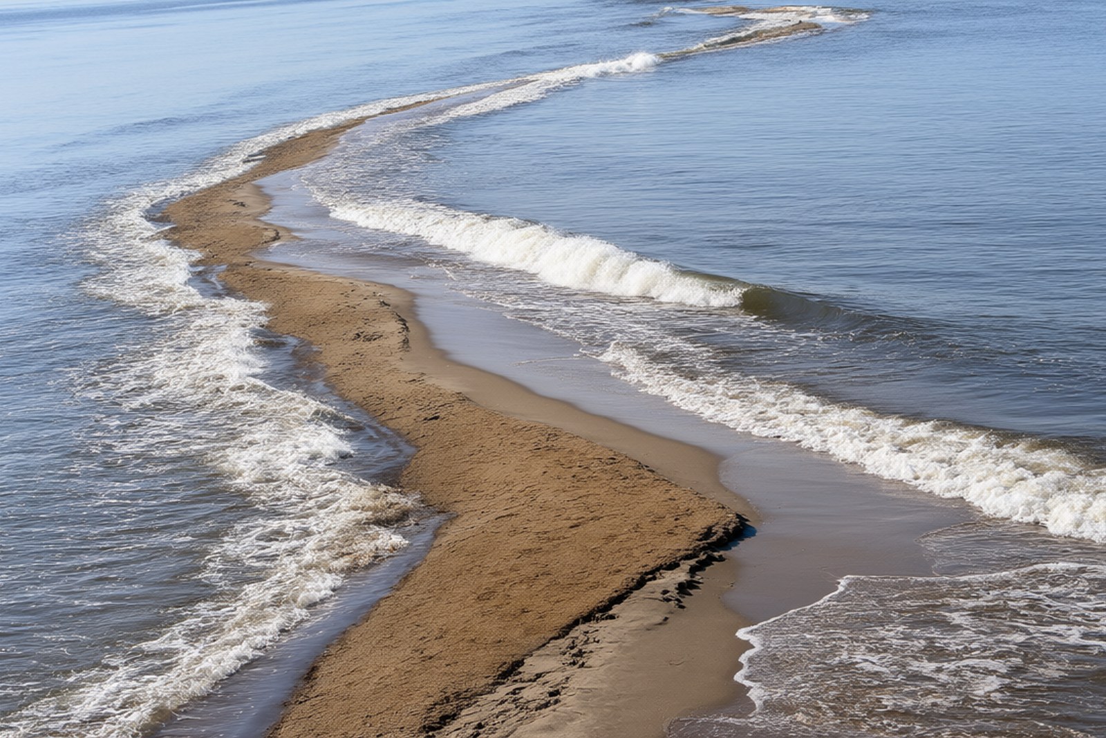
The spit has one more thing on it: a stretch of beach where the 玳瑁 dài mào, the hawksbill turtle, comes ashore, which is a national second-class protected animal and one of the reasons walking is restricted in places. The sand itself is worth noticing. Where the tide does not reach it is loose and pale and blows about; where the water has been over it, it compacts to a hard amber surface that a fisherman can ride a bicycle along leaving nothing but a wet tyre mark. Come in the early morning if you want the light and the emptiness, come at low tide if you want to walk out onto the point, and take the boat rather than trying to reach it on foot from the mainland, because the spit is an island for most of the day.
Practicalities
Tickets. Reaching 玉带滩 is by boat from the landing at the 博鳌亚洲论坛永久会址 Bó’áo Yàzhōu lùntán yǒngjiǔ huìzhǐ, the forum’s permanent site near 东屿岛, and the boat ticket is about ¥60 to ¥90 return including the landing fee. There is no separate charge for the shoal itself, and the boat runs on a schedule rather than on demand.
Opening hours. The boats run roughly from 08:30 to 17:30, less often in the middle of the day, and the last return is generally in the late afternoon. Allow two to three hours for the crossing and the walk. The light on the water is best before ten in the morning; the middle of the day is hot and there is no shade anywhere on a sand spit.
Getting there. 博鳌镇 is about twenty kilometres south of 嘉积镇 Jiā jī zhèn, the 琼海市 seat, and 博鳌站 Bó’áo zhàn on the 东环 high-speed line is a few kilometres inland; 琼海博鳌机场 Qiónghǎi Bó’áo jī chǎng is about twenty minutes by road. From the station a taxi to the forum site takes about ten minutes, and the boat leaves from there. A car or a taxi is needed for everything except the waterfront itself.
Closing day. There is no closing day as such, but the boats do not run in bad weather or heavy swell and the landing closes then, which in the typhoon season from July to October can mean a day or two at short notice. The site is at its busiest over the October week, the Spring Festival and during the forum’s own week in spring, when parts of the foreshore are closed for the meeting.
flowcloud would say that a river which has been dropping sand across its own mouth for several thousand years, and which has ended up with a wall ten metres wide holding back the sea, has produced the sort of landmark that no engineer would dare to design and that the county has had the sense not to touch.
Getting there: 玉带滩 is reached by boat from the landing at the 博鳌亚洲论坛永久会址 in 博鳌镇, 琼海市, about ten minutes by road from 博鳌站 Bó’áo zhàn on the 东环 high-speed line and twenty kilometres from 嘉积镇; there is no road onto the spit.