
丹霞山 Dān xiá shān is the place the rest of the world’s 丹霞地貌 dān xiá dì mào – danxia landform – is named after, and almost everything worth saying about it follows from that one fact. It stands in 仁化县 Rén huà xiàn on the north-east edge of 韶关市 Sháo guān shì, about fifty kilometres from the prefecture city, and its 292 square kilometres make it the largest scenic area in 广东 Guǎng dōng. The name is not a description of the rock, which is red; it is a quotation from a poem, and the phrase that produced it, 色如渥丹,灿若明霞 sè rú wò dān, càn ruò míng xiá – coloured like thick cinnabar, bright as the glow of dawn – has been attached to the mountain since the old gazetteers. The 广东通志 Guǎng dōng tōng zhì, the provincial gazetteer, calls it by an older name, 锦岩 Jǐn yán, brocade cliff, and counts it among the four famous mountains of the province. Nobody comes here to look at one hill. The landform is the exhibit: 680-odd red sandstone and conglomerate peaks, walls, towers and natural bridges, most of them between 300 and 400 metres, the highest 巴寨 Bā zhài at about 618 metres, with 88 recorded geological relic sites inside the boundary, of which 25 are graded world class and 57 national.
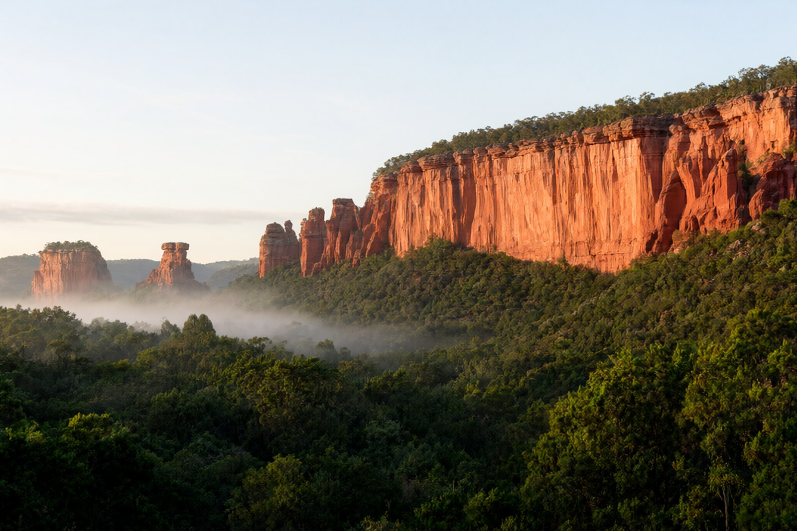
The two dates that get confused are worth separating at the start, because they are ten years and two entirely different competitions apart. In February 2004 the mountain was approved by UNESCO as one of the first batch of world geoparks anywhere in the world – not the first in China, the first globally, alongside a short list of sites that had been assessed for the new network in that round. Then in August 2010 the serial nomination “China Danxia”, for which 丹霞山 was the lead site, was inscribed on the World Heritage List as a world natural heritage site, China’s eighth and Guangdong’s first – and still Guangdong’s only one. It is 5A-rated, a national scenic area, a national nature reserve and a national geopark, and it has held the geopark status since 1988 in one form or another, but the two dates above are the ones that matter and they should never be written as one. The geology behind them is a single long sequence: an inland basin through the 140 million to 70 million years before the present, filling with thick red beds as the Himalaya-building movements pushed the crust about; uplift and erosion after that; and repeated intermittent uplift over the last six million years – the local figure is roughly a metre every ten thousand years – with water cutting down through the joints of the sandstone to leave the flat top, the sheer face and the gentle foot that the landform’s definition asks for. 丹霞山 is what that process produces at its middle-to-late mature stage, in a clustered group of peak forests rather than a single peak, and it is the reason the term was coined here rather than imported.
In the 1920s the Chinese geologist 冯景兰 Féng Jǐng lán and his colleagues, working on this rock, formalised the unit and gave it the mountain’s name, and the type section for the whole classification has been read here ever since, which is why the county’s own description says the research on stratigraphy, structure, geomorphic expression and development is more detailed and deeper at 丹霞山 than at any other danxia area in the country. The mountain is a permanent research site as a result, and the geologists who work it come here to compare every other danxia landscape in the country against this one.
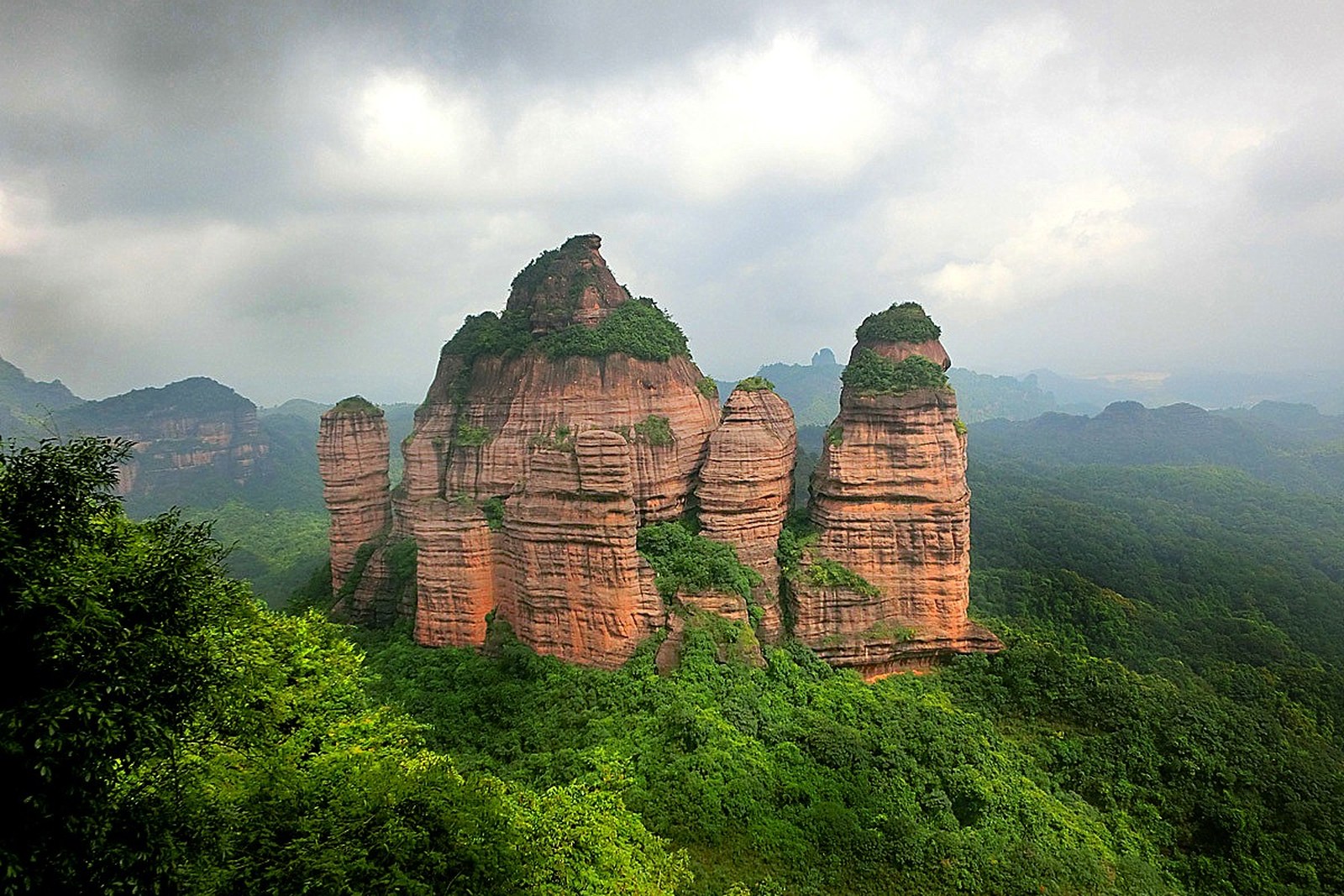
The walkable mountain is organised into four or five separate grounds connected by the park shuttle, and the shuttle stop names are the way to plan a day. 长老峰 zhǎng lǎo fēng, the elder peak, is the sunrise mountain: the path climbs to 观日亭 guān rì tíng, the sun-watching pavilion, and people start up at four in the morning to be sitting on the rock when the light comes, with a cable car at 40 yuan one way and 70 return for anyone who would rather not. 阳元山 yáng yuán shān is the sunset side and the rock that everyone photographs: a natural pillar standing clear of the cliff, 28 metres of it, weathered out of the sandstone along the bedding and the joints, with a viewing platform opposite. 翔龙湖 xiáng lóng hú, the soaring dragon lake, is the water-and-cave ground and the link across to 阴元石 yīn yuán shí; 锦江 jǐn jiāng is the river below the peaks, and the 水上丹霞 shuǐ shàng dān xiá boat, 50 yuan, is the only way to see the cliffs from the bottom of them, which is the view the painters kept choosing. Two monasteries are inside the boundary and are older than any of the signage: 锦石岩寺 jǐn shí yán sì, the temple built into the overhang halfway up the cliff face, where the rock itself is the roof; and 别传寺 bié chuán sì, the other of the mountain’s two famous religious buildings. The human record underneath all of this starts a long way back. There were people of the ancient 百越 bǎi yuè living here in the Neolithic, leaving what the archaeology calls the 鲶鱼转文化遗址 nián yú zhuǎn wén huà yí zhǐ, and they built in the natural caves rather than beside them, which set a pattern that never stopped: the local phrase for the mountain’s later history is 逢山有寨、逢寨有门、逢门必险 féng shān yǒu zhài, féng zhài yǒu mén, féng mén bì xiǎn – wherever there is a hill there is a stronghold, wherever a stronghold there is a gate, and every gate is a hard one – and the remains of those stockades, of temples, of cliff inscriptions, steles, rock shrines and hanging coffins are scattered across the massif. The 仁化县志 Rén huà xiàn zhì, the county gazetteer, kept a 丹霞山图 Dān xiá shān tú, a map of the mountain, in its Tongzhi-reign edition, which is a nice reminder that this was a place people navigated on paper long before there were footpaths and handrails. The biological count is the part visitors rarely arrive expecting and the part that justifies the nature-reserve status on its own. As of June 2022 the reserve had recorded 2,270 species of higher plant, 1,516 insects and over a hundred spiders, 447 vertebrates – 248 birds, 29 amphibians, 72 reptiles, 48 mammals and more than fifty kinds of fish – and 300 species of macrofungus. Eleven plant species and 32 animal species on the national protected lists occur here, including clouded leopard, musk deer, black muntjac, Cabot’s tragopan and pangolin. The headline figure is 26 species new to science discovered and named at 丹霞山, most of them extremely local endemics with very small populations, and the plant with the mountain in its name is 丹霞梧桐 dān xiá wú tóng, a maple relative found on the cliff faces. The place runs a serious education programme and has done for years: around 400,000 people a year come through it for the research-study and nature-education courses, and over 200 such courses have been developed here, which is how a geological type locality pays for its own protection.
For the visitor the practical shape of a good two days is straightforward and the county has published it: day one the visitor centre, 阳元山, 阳元石, the 云崖栈道 yún yá zhàn dào cliff walk, the 九九天梯 jiǔ jiǔ tiān tī ladder of steps, and 细美寨 xì měi zhài for sunset off its platform; day two 长老峰 and 观日亭 for sunrise, then 锦石岩寺, 韶音亭 sháo yīn tíng, 翔龙湖 and 阴元石, with the boat on the 锦江 fitted in wherever the light is best. The season changes the mountain more than most people expect. Spring brings the mist that the painters came for and the new green on the lower slopes; the summer months are hot on the exposed rock and the afternoon storms shut the ladders, which is why the shuttle and the boat do their best business in the morning; autumn is the settled, clear season and the one that makes the two-day plan work; and winter is quiet, dry and cold at dawn on 长老峰, with the plum and the bare trees showing the shape of the ridges more clearly than the full canopy does. It is worth knowing that the ticket is 100 yuan for an adult and is valid for 48 hours with multiple entries, that the shuttle runs 6:30 to 18:00 and stops at the outer gate, 阳元山, the museum, 宝珠峰 for the cable car and 长老峰, and that private cars are not allowed up the mountain, which is why the villages at the foot of it exist in the first place.
Practicalities
Tickets. 100 yuan for an adult, valid for 48 hours with unlimited re-entry, and it includes the shuttle. Half price at 50 yuan for ages 6 to 18, full-time students and the 60 to 64 bracket; free under six or under 1.2 metres and over 65. The cable car on 长老峰 is 40 one way and 70 return, the 锦江 boat is 50, and parking is free for the first half hour and capped at 15 yuan for 24 hours. Buy at the gate: there is no discount worth chasing through a reseller and the ticket’s value is entirely in the 48-hour re-entry.
Opening hours. The park itself is open about 08:00 to 17:00 in the ordinary way, but the two hours that matter are outside that: 长老峰 for sunrise and the 阳元山 side for sunset. The shuttle starts at 6:30 and the last one down is around 18:00, so a sunrise on the elder peak means being at the stop before the first bus and a sunset at 细美寨 means knowing which shuttle you are catching back. On a wet or foggy morning the sunrise is often a wall of white, and the mountain is famous enough for this that the local advice is to give it two mornings rather than one.
Getting there. By high-speed rail to 韶关站 Sháo guān zhàn, which is the 武广 Wǔ guǎng line’s first station inside Guangdong: out of the exit and about 100 metres to the left front, or 50 metres to the numbered bay, is the 丹霞山 express bus to 仁化, about 70 minutes and about 21 yuan. From the older 韶关东站 Sháo guān dōng zhàn on the ordinary railway it is about a 50-metre walk to the same kind of bus, roughly 50 minutes, first departure 06:50 and every 15 to 30 minutes after that. 丹霞山站 Dān xiá shān zhàn, on the 赣韶 Gàn sháo line at 周田镇 in 仁化, is the shortest way in of all – about 20 minutes by bus from the station to the gate, saving something like an hour over coming from the city centre. By road, the 武深 Wǔ shēn expressway exit puts you about five kilometres from the gate and the 南韶 Nán sháo exit about twelve, off the 106 national road.
Closing day. No weekly closing day; the scenic area is open every day of the year, and its two annual interruptions are weather rather than calendar – typhoon rain in summer, when the cliff walks and the 九九天梯 are shut for safety, and occasional maintenance on the cable car. The 48-hour ticket means a rained-off first day is not a wasted one, which is the strongest argument for buying it at the gate on arrival rather than in advance.
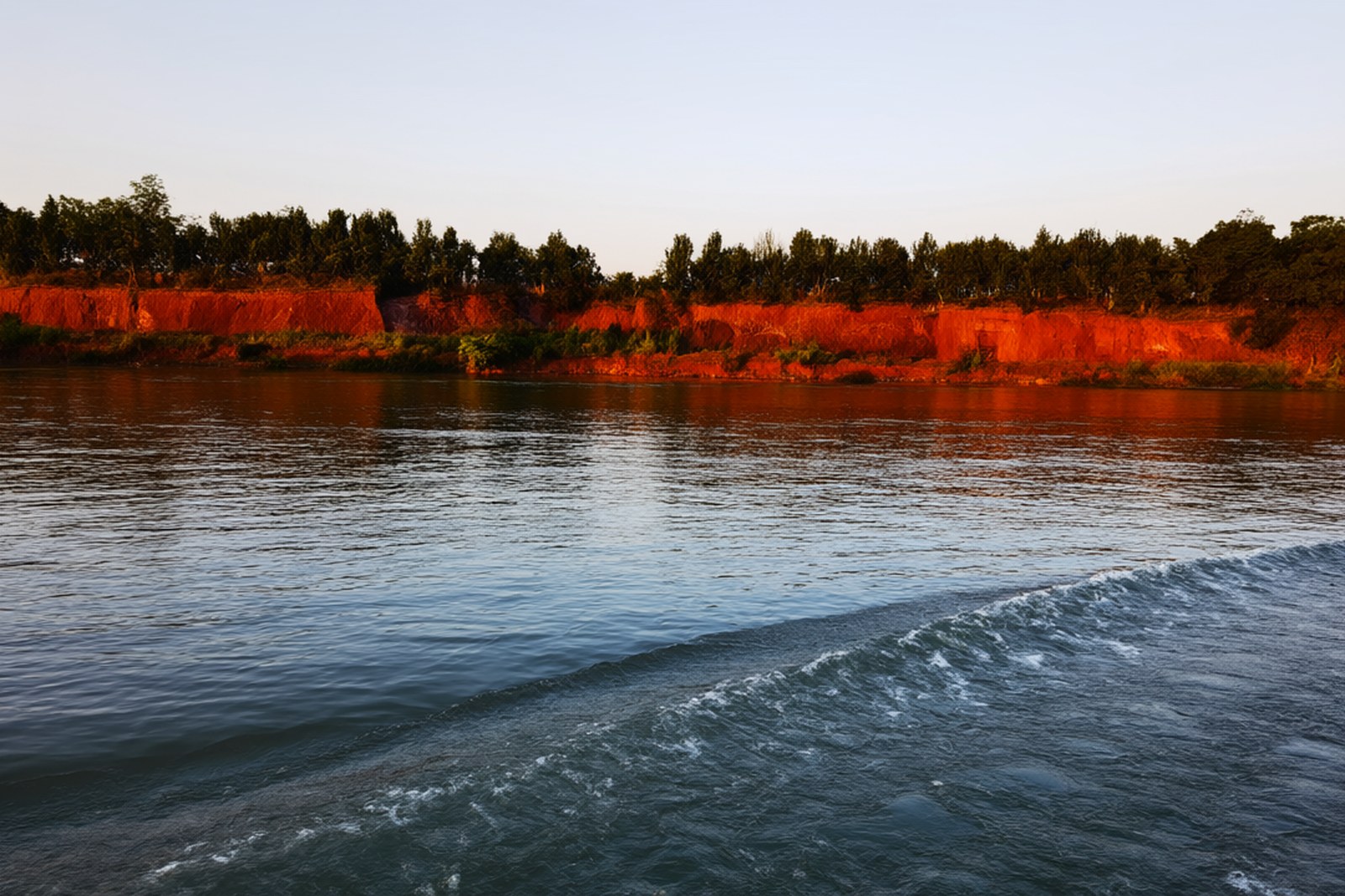
flowcloud would say that a mountain which lent its name to a whole branch of geology has an unusual obligation – to be legible as well as beautiful – and that the reason 丹霞山 repays two days rather than one afternoon is that the red walls are only half the argument, while the 2,270 plants, the 26 species nobody had named before they were found here and a metre of uplift every ten thousand years are the other half, and they are the half that makes the view mean something.
Getting there: 丹霞山 is in 仁化县 Rén huà xiàn, 韶关市, on the north-east edge of the prefecture about fifty kilometres from the city centre; 韶关站 Sháo guān zhàn on the 武广 Wǔ guǎng high-speed line and 韶关东站 Sháo guān dōng zhàn on the ordinary railway both have express buses to the mountain, seven or eight yuan more than the local fare and about 70 and 50 minutes respectively, and 丹霞山站 Dān xiá shān zhàn on the 赣韶 Gàn sháo line at 周田镇 is only about twenty minutes from the gate and is the quickest way in of the three. 韶关丹霞机场 Sháo guān dān xiá jī chǎng, which opened in November 2021, is the nearest airfield; by road the 武深 and 南韶 expressways both have dedicated exits.