
Under the Highest Peak: Everest Base Camp
绒布寺前抬望眼,珠峰一柱立西天 Róngbù Sì qián tái wàng yǎn, Zhūfēng yī zhù lì xītiān – Raise your eyes before Rongbuk; the Everest pillar stands against the western sky
珠峰大本营 Zhūmùlǎngmǎ Dàběnyíng Everest Base Camp sits at around 5,200 meters at the end of the Gawu La switchbacks in 定日县 Dìngrì Xiàn Dingri county, 西藏自治区日喀则市 Xīzàng Zìzhìqū Rìkāzé Shì Shigatse – a gravel flat between tent compounds and prayer flags with the world’s highest peak filling the viewfinder at the valley’s end. The north face of Everest rises the last three and a half vertical kilometers almost straight above the valley floor, close enough that the wind plume off the summit is clearly visible on most mornings.
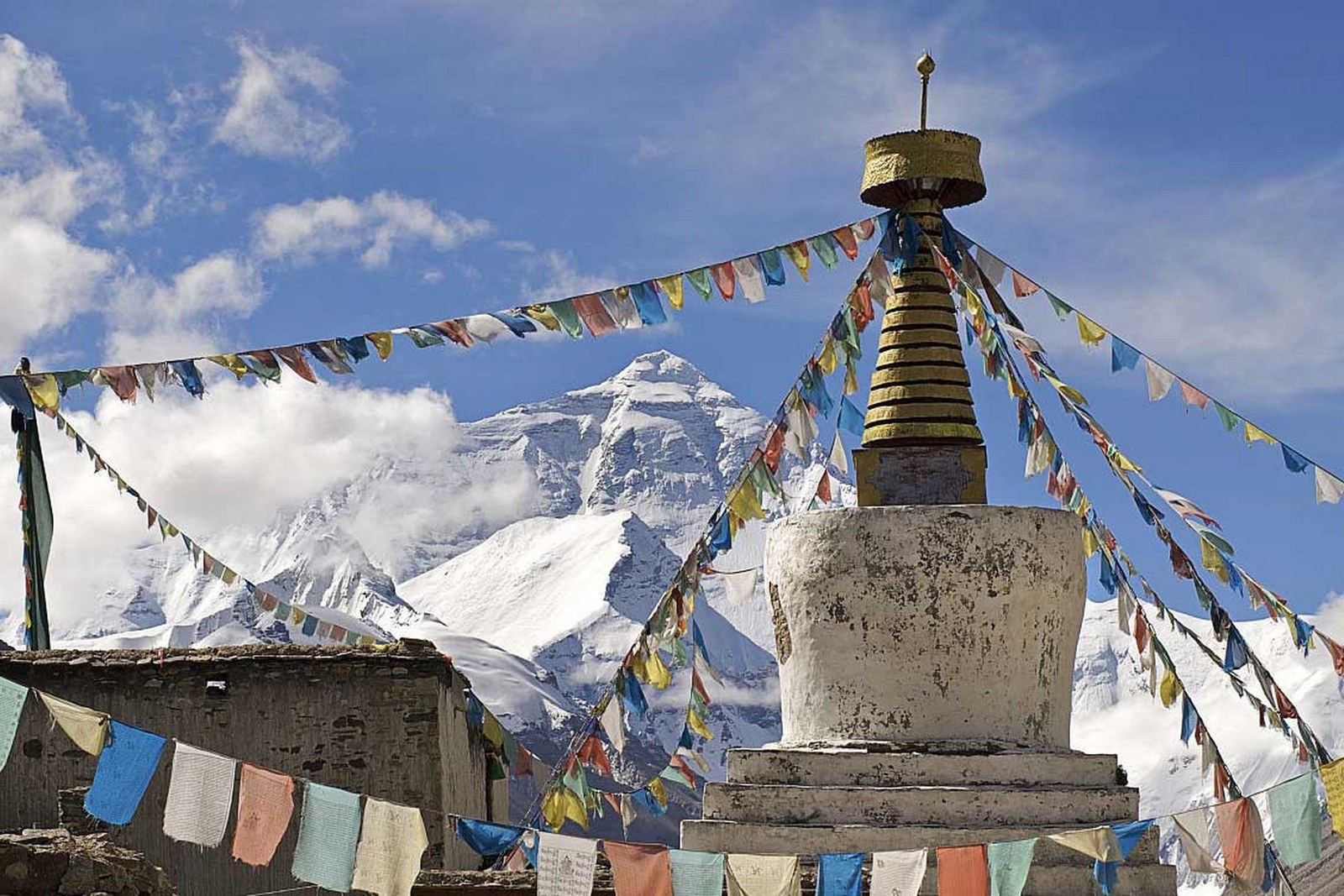
The approach is part of the monument. The road from Shegar climbs in hairpins to the Gawu La pass – where four 8,000-meter summits line up on clear days – then drops through barren valley walls to Rongbuk, the highest monastery on earth, its whitewashed buildings dwarfed by the amphitheater of peaks. The last kilometers reach the camp’s tent compounds, where padded beds, hot pots and stoves make a village that exists only for the mountain.
Timing is everything at base camp. From April to early June the expedition tents fill the flat and the stone elevation marker makes the classic photograph; mornings give the calmest, clearest face of the summit; and the evening golden cap – the last sun lighting the pyramid while the valley falls into blue shadow – is the shot photographers wait hours in the cold for. After dark the sky takes over: at 5,200 meters with no town for kilometers, the stars and the Milky Way wheel over the tents with a brightness lowland eyes read as unreal.
What base camp means is written in the people it draws. Climbing expeditions sort ropes and oxygen beside the tents; pilgrims circle with their own devotions; day-trippers in down jackets photograph the marker; and monastery guests hear morning prayers from the world’s highest chapel. The mountain organizes all of them into the same silent audience – and whatever brings each traveler up the valley, the moment the summit suddenly fills the windscreen around the last bend is the same for everyone.
Practicalities
- The frontier pass and the Everest scenic-area ticket are required – arrange both in Shigatse or Lhasa before the drive.
- The drive from Shigatse takes a full day via Tingri; overnight at the valley villages or the camp tents and return the next morning.
- Nights run far below freezing in every season – bring a parka, gloves and a headlamp; oxygen is available at the tent camps.
- April-June and September-October give the clearest summit views; July-August is monsoon cloud season.
Words and Names
珠穆朗玛峰 Zhūmùlǎngmǎ Fēng Mount Everest, the “goddess mother of the world”; 珠峰大本营 Zhūfēng Dàběnyíng Everest Base Camp; 绒布寺 Róngbù Sì Rongbuk Monastery, the highest monastery on earth; 加乌拉山口 Jiāwūlā Shānkǒu the Gawu La, the pass with the four-peak panorama; 定日 Dìngrì Dingri, the county on the Everest road; 玛尼堆 mǎní duī the stacked stone cairns of the pass. Beyond the camp, the same 西藏自治区日喀则市 Xīzàng Zìzhìqū Rìkāzé Shì Shigatse keeps more places worth the detour: 萨迦寺 Sàjiā Sì the grey citadel on the road west, 扎什伦布寺 Zhàshílúnbù Sì the Panchen Lamas’ seat in Shigatse, 白居寺 Báijū Sì the Kumbum stupa at Gyangtse, or 江孜宗山古堡 Jiāngzī Zōngshān Gǔbǎo the fortress of the wool road – four more doors into the same Shigatse. Once the mountain is behind you, our Shigatse food map fills the table.
flowcloud would say base camp is the one sight that outgrows its own postcards: no photograph holds the scale, the wind and the silence together, and everyone who walks the last hundred meters falls quiet at the same moment. All checked November 2026.
Getting there: Independent travel to the camp requires the frontier pass and the Everest scenic-area ticket, normally arranged in Shigatse or Lhasa. The drive from Shigatse takes a full day via Tingri; the Gawu La pass and Rongbuk are the last leg. April-June and September-October offer the clearest summit views. All checked November 2026.