
双山夹一江,溜索渡苍茫。Shuāng shān jiā yī jiāng, liūsuǒ dù cāngmáng – Two mountains clasp one river; the zipline ferries across the vastness.
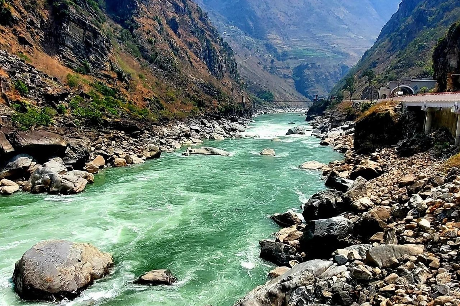
怒江大峡谷 Nùjiāng Dàxiágǔ the Nujiang Grand Canyon is not a gated theme park with a ticket booth and a shuttle — it is, in the plainest sense, the 怒江 Nùjiāng Nu River (the Salween) having spent a few million years cutting a slot between 高黎贡山 Gāolígòng Shān the Gaoligong Mountains to the west and 碧罗雪山 Bìluó Xuěshān the Biluo Snow Mountain to the east, straight down the spine of 怒江傈僳族自治州 Nùjiāng Lìsùzú Zìzhìzhōu Nujiang Lisu Autonomous Prefecture. The gorge is one of the deepest on earth — walls rising two thousand metres and more above a river that runs green, fast and permanently angry — and it sits inside the 三江并流 Sānjiāng Bìngliú Three Parallel Rivers UNESCO World Heritage landscape, where the Nu, the 澜沧江 Láncāng Jiāng Lancang (Mekong) and the 金沙江 Jīnshā Jiāng Jinsha (Yangtze) run for hundreds of kilometres within a few dozen kilometres of one another and never, ever meet. What you are actually driving through, for most of its length, is a cliff-hung highway and a string of 傈僳族 Lìsùzú Lisu, 怒族 Nùzú Nu and 独龙族 Dúlóngzú Drung villages — the “canyon” is the road and the river, not a viewpoint you pay to enter.
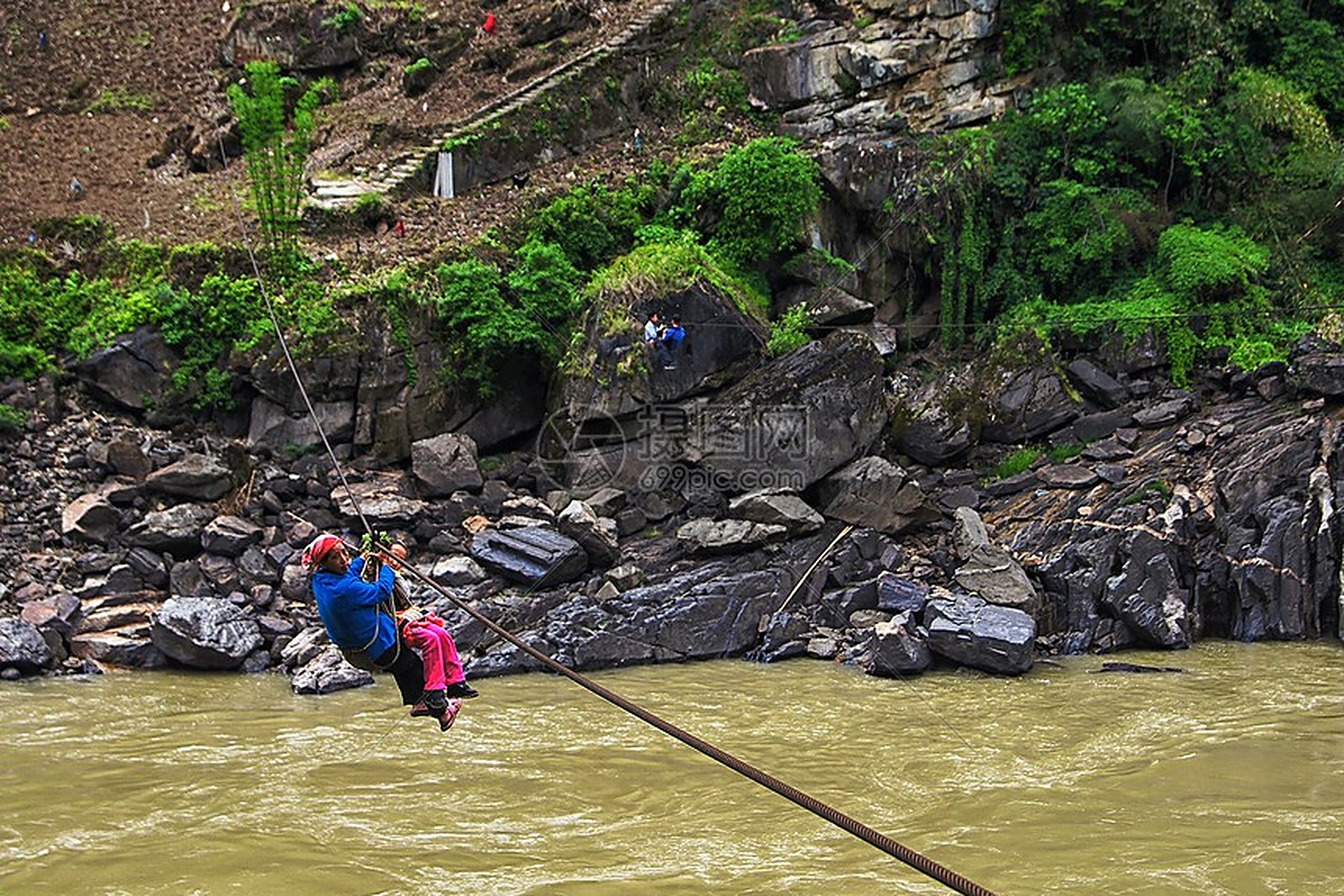
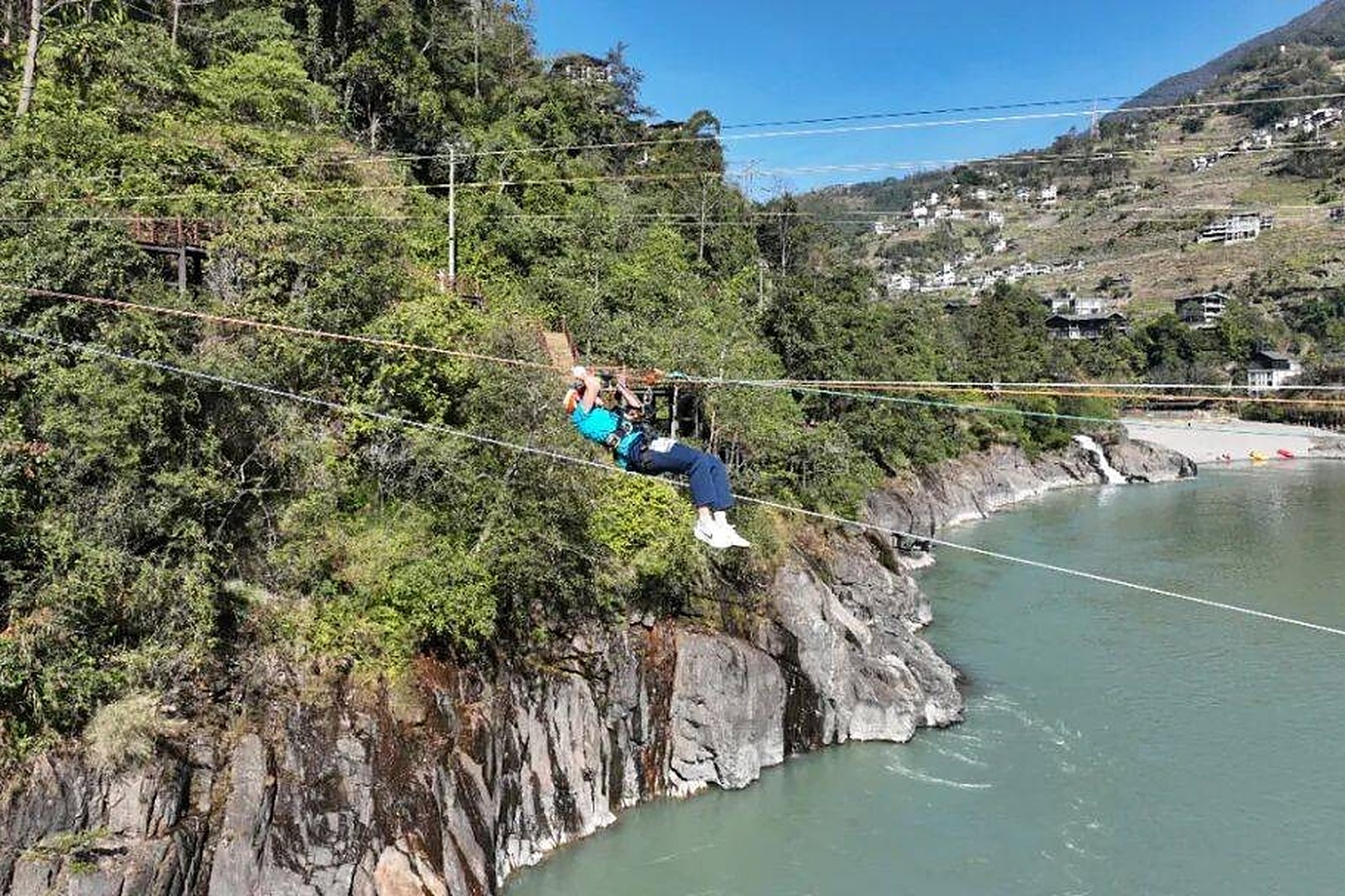
The honest grade is therefore “a free corridor, not a scenic spot,” and that is its strength and its weakness. The 怒江大峡谷 Nùjiāng Dàxiágǔ is part of the national 风景名胜区 fēngjǐng míngshèngqū scenic area designation that wraps the whole Three Parallel Rivers region, but there is no single gate, no unified ticket; you simply drive the 怒江美丽公路 Nùjiāng Měilì Gōnglù the Nujiang “Beautiful Road,” a rebuilt ribbon along the old G219 corridor that finally gave the prefecture a sealed two-lane artery in the late 2010s. The one paid thrill is the 溜索 liūsuǒ zipline — the rope-and-cable river crossings that were, until the bridges came, the only way to get from one bank to the other because the 怒江 Nùjiāng is too deep, too cold and too fast to ferry. Most working 溜索 are gone now, replaced by the road’s 桥 qiáo bridges, but a handful survive as tourist rides and may cost a small fee of about 50–100 yuan (worth confirming the operator and price — the surviving ones are cash and a harness, not an attraction with a website), and they are the single most photogenic relic of the old gorge life.
The wry truth is that the canyon is China’s most remote prefecture and proud of it: there is no railway, and for years there was not even a proper airport (a small 怒江 Nùjiāng airfield has been discussed and partly built, but do not plan your itinerary around a scheduled flight worth confirming before you book anything that depends on it). You arrive overland — roughly four to five hours by road from 大理 Dàlǐ Dali, a little less from 保山 Bǎoshān Baoshan — on a road that clings to the cliff, narrows to a single lane in places, and is closed or crawled by 塌方 tāfāng landslides through the June-to-September rains. The dry October-to-April window is the only sane season. What is overrated is the “world’s deepest canyon” superlative, which sells a drama the highway mostly hides behind villages and haze; what is worth it is the specific set pieces — the 怒江第一湾 Nùjiāng Dìyī Wān First Bend near 丙中洛 Bǐngzhōngluò, the 石月亮 Shíyuèliàng Stone Moon, the hillside churches — not the endless middle stretch of road you merely survive. Pack motion-sickness pills, a driver who knows the bends, and zero expectation of a rail connection.
Practicalities
- Rating: A free, open riverine gorge and the spine of Nujiang Prefecture, lying inside the Three Parallel Rivers UNESCO World Heritage landscape; part of the national scenic-area designation, but not a fenced, ticketed “spot” in itself.
- Tickets: Free to drive the 怒江美丽公路 Nùjiāng Měilì Gōnglù corridor; the surviving 溜索 liūsuǒ zipline rides may cost about 50–100 yuan (worth confirming operator and price). No unified canyon gate fee.
- Address: Runs the length of Nujiang Prefecture (泸水市 Lúshuǐ Shì Lushui / 六库 Liùkù Liuku seat) between the Gaoligong and Biluo ranges; accessed by the G219 / Beautiful Road from 大理 Dàlǐ or 保山 Bǎoshān. No railway.
- Time needed: The full north–south drive is a full day of road; budget two to three days to actually stop at the bends, the villages and the Stone Moon rather than just transit through.
Words and Names
怒江大峡谷 Nùjiāng Dàxiágǔ Nujiang Grand Canyon · the deep gorge of the Nu/Salween between Gaoligong and Biluo, free to drive 怒江 Nùjiāng Nu River · the Salween, the raging river that names and cuts the prefecture 高黎贡山 Gāolígòng Shān Gaoligong Mountains · the western wall of the canyon, a biodiversity frontier 碧罗雪山 Bìluó Xuěshān Biluo Snow Mountain · the eastern wall of the canyon across the river 三江并流 Sānjiāng Bìngliú Three Parallel Rivers · the UNESCO landscape the canyon belongs to 溜索 liūsuǒ zipline · the old rope river crossings, now mostly tourist relics 傈僳族 Lìsùzú Lisu people · the prefecture’s largest ethnic group, riverside and hillside dwellers 怒族 Nùzú Nu people · one of the valley’s smaller Tibeto-Burman groups 独龙族 Dúlóngzú Drung people · the tiny group of the far-west Dulong valley 怒江美丽公路 Nùjiāng Měilì Gōnglù Nujiang Beautiful Road · the rebuilt G219 corridor highway 塌方 tāfāng landslide · the rainy-season hazard that closes the cliff road
flowcloud would say that the 怒江大峡谷 Nùjiāng Dàxiágǔ is China’s most remote prefecture sliced open by the 怒江 Nùjiāng between 高黎贡山 Gāolígòng Shān and 碧罗雪山 Bìluó Xuěshān — a free road corridor, not a gate — and that the honest move is the dry October-to-April drive with a driver who knows the bends, one 溜索 liūsuǒ ride for the photo and zero reliance on a railway, because the canyon’s drama lives in its bends and churches, not in the haze-hidden middle stretch. All checked October 2026.
Getting there: the whole corridor along the G219 from 六库 Liùkù north to 丙中洛 Bǐngzhōngluò – the canyon IS the road; 六库 Liùkù is five to six hours by bus from 大理 Dàlǐ (worth confirming schedules), the gorge runs best north-to-south by hired car, and the honest season is October to May because summer rain brings rockfalls. All checked October 2026.