
Crossing the Braided River: The Tarim Bridge and the Gold of Autumn
长桥跨大河,金水绕胡杨 Chángqiáo kuà dàhé, jīnshuǐ rào húyáng – A long bridge crosses the great river; golden water winds through the poplars
正文:塔里木河大桥 Tǎlǐmù Hé Dàqiáo the Tarim River bridge is where Aral meets its river properly – a long highway crossing at the southern edge of 阿拉尔市 Ālā’ěr Shì Aral City, launched over a watercourse that refuses to behave like one river. The Tarim here runs braided: a kilometres-wide corridor of shifting channels, gravel bars and golden poplar flats stitched together by hydraulic works, and the bridge reads the whole braid in a single sweep. For most visitors it is the first sight of the famous river, and it is a good one – less a crossing than an observation deck with traffic on it.
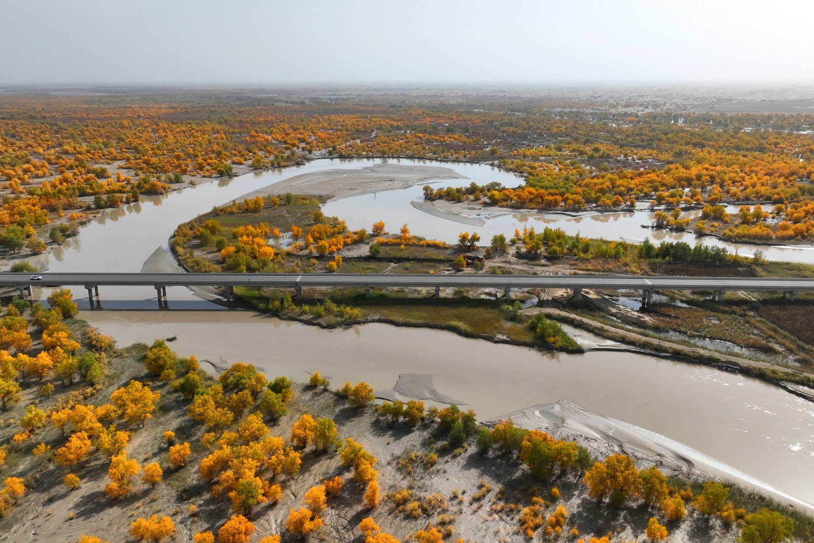
The bridge’s setting is the spectacle. Upstream the river gathers from the Aksu, Yarkand and Hotan systems into the Tarim’s main stem; downstream it runs the long loneliness toward the lost delta. At Aral the flood season – summer, fed by the mountain glaciers – spreads the channels wide and brown; autumn drops the water to ribbons of blue between banks of pure gold; and the aerial photographs that made this reach famous – bridge, braid and poplar in one frame – are taken from the viewing tracks on the eastern bank, where the city keeps a riverside park.
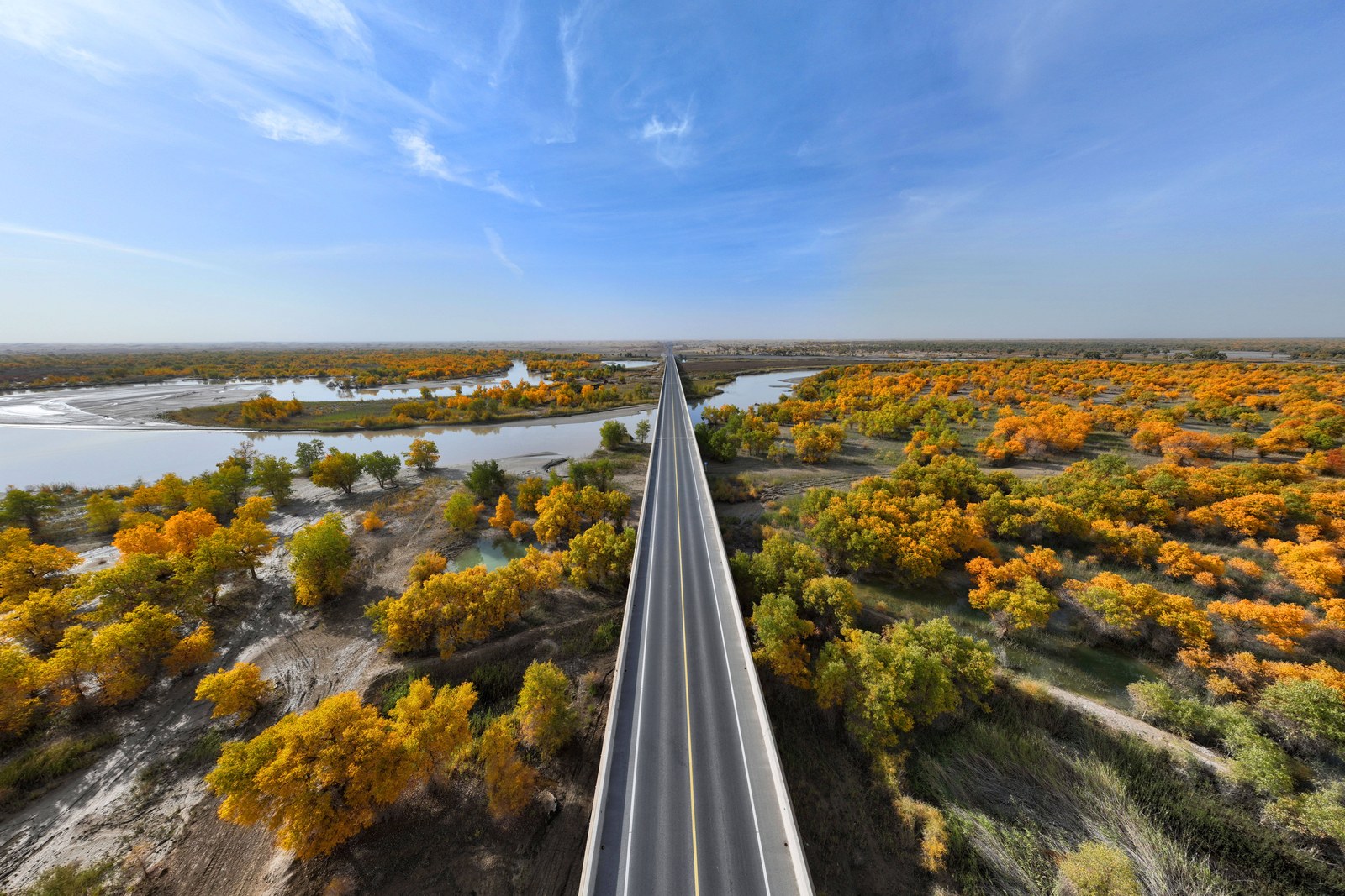
The engineering is worth a look on its own terms. The bridge carries the desert highway south – the road that walks straight into the taklamakan toward Hotan – and its approaches run on embankments anchored by the same poplar shelterbelts that tamed the surrounding flats. Flood piers stand in ranks to take the summer pulse; the main span clears the deepest channel; and the whole structure hums with a surprising amount of life: cotton trucks in October, motorbikes all year, and the evening strollers who treat the sidewalks as the city’s best sunset promenade.
Time a visit to the river’s moods. Summer high water is drama – brown torrents dragging islands of reed downstream while herons work the slack water. Autumn is the postcard: low blue channels, the poplar flats at full gold and the bridge cutting a clean line through the colour. Winter freezes the margins into lace; spring brings the sandstorm light and the first green haze along the banks. The golden half of October is the safest bet for the classic frame, and the river park below the eastern approach gives the best low-angle views without climbing the traffic bridge.
The bridge is also the gateway south. The desert highway’s first kilometre marker stands at the southern approach, where the poplar country ends and the dune country begins – a fifteen-minute drive from the city centre that goes from river gold to open sand in one unbroken shot. Travellers who continue south use the bridge town as the last fuel and food stop, and the parking area below the bridge keeps the feel of a staging camp: trucks idling, photo stops, the desert ahead.
Practicalities first. The bridge lies ten minutes south of central Aral on the desert-highway approach; any taxi makes the trip and waits, the eastern river park offers the safe viewing tracks, and the open ground east of the park is where photographers spread out – the highway corridor itself is restricted. Sunset is the viewing hour; October evenings are cold, so bring a layer.
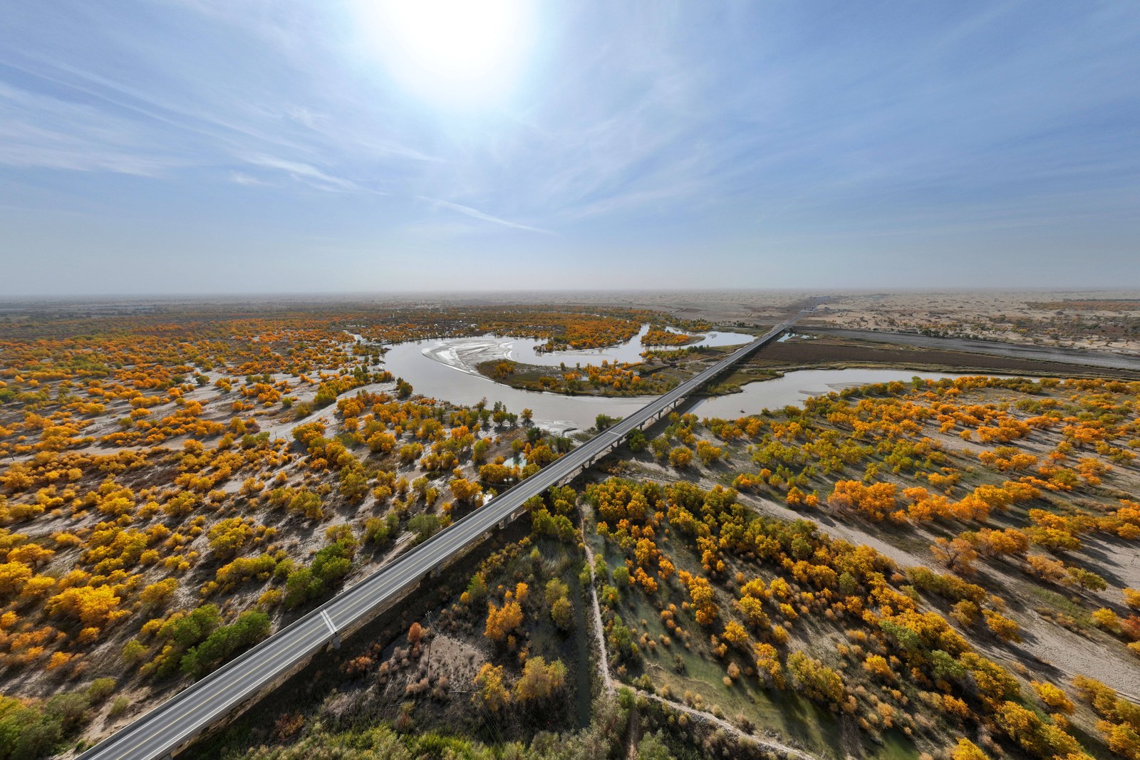
Widen the frame and the bridge completes Aral’s story: the memorial and university explain the city, the sleeping valley shows the forest that welcomed the first planters, and the bridge shows the river that made it all possible – tamed, measured and crossed, but still wide enough to feel like the main event.
And that is the lasting impression: a river more than a bridge. The traffic crosses in minutes; the braid below takes an hour just to look at; and from the eastern tracks at dusk – water running gold, poplars burning on the bars – the Tarim feels exactly like what it is, the longest inland river in the country, doing its slow work through the desert.
Practicalities
Beyond the bridge, the same 阿拉尔市 Ālā’ěr Shì Aral City keeps more places worth the detour: 三五九旅纪念馆 Sānwǔjiǔ Lǚ Jìniànguǎn the 359 Brigade Memorial for the founding story, 塔里木大学 Tǎlǐmù Dàxué Tarim University for the campus walk, 睡胡杨谷 Shuì Húyáng Gǔ the Sleeping Huyang valley for the standing dead forest, or 千鸟湖湿地 Qiānniǎo Hú Shīdì Qianniao Lake wetland for the egret evening – four more doors into the same 阿拉尔市 Ālā’ěr Shì Aral City. Once the bridge is crossed, our Aral food map fills the day.
Practicalities
Words and Names
flowcloud would say the Tarim bridge is Aral’s front porch over its own river: brown floods in summer, blue ribbons in autumn, and the desert highway running south off the far ramp as if the horizon owed it a road. All checked November 2026.
Getting there: The bridge crosses the river at the city’s southern edge on the desert-highway approach; taxis reach it in ten minutes from downtown. Stop at the river beach below for the braided channels – sunrise and dusk give the best light. All checked November 2026.