
The West Border of Water: The Toutun River Green Belt
一河分两城,两岸绿成荫 Yī hé fēn liǎng chéng, liǎng’àn lǜ chéng yīn – One river divides two cities; green shade grows on both banks
正文:头屯河谷 Tóutún Hé Gǔ the Toutun river valley runs down Wujiaqu’s western rim – the river that historically separates the Urumqi side from the Changji side and now threads a green belt of wetlands, boardwalks and poplar groves between the city and the gobi. Where the river meets the plain the corps built a chain of small reservoirs and settling ponds, and the water that survives the desert crossing arrives clean enough to keep herons, kites and an ever-growing wetland park on the city’s quietest edge.
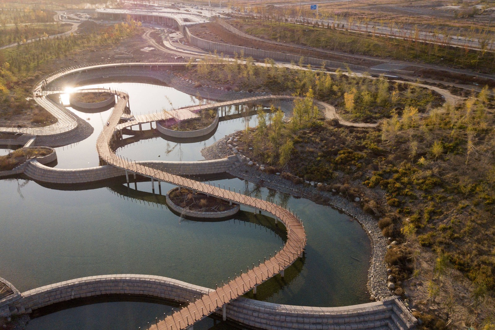
The boardwalk wetland is the belt’s signature. Timber walks loop through golden reed beds and shallow ponds, crossing the channels on low bridges where the water slows and the birds settle – kites hover over the grass in summer, and autumn turns the whole valley floor amber around the meanders. Cyclists share the paved greenway on the bank above; families claim the shaded tables under the poplars on weekends; and the evening light down the valley corridor is the softest in the whole city.
Walk the belt in one stretch: start at the northern boardwalk section where the reeds are thickest, follow the greenway south past the settling ponds, and finish on the levee where the city skyline reads across the water. The path is flat and paved the whole way, benches arrive at every bend, and the full circuit takes an easy hour and a half – less if you skip the levee, more if the kite display holds you at the meadows.
The valley also carries the plumbing that keeps Wujiaqu alive. Headgates and canal offtakes mark the bank at intervals – the Toutun feeds the Qinggeda system from the south, and the green belt doubles as the city’s flood corridor. Reading the waterworks as you walk is part of the honest charm: this is a working river edge, engineered by the same regiments that planned the streets, and kept wild enough on purpose that the birds still treat it as home.
For photographers the meanders are the money shot. The boardwalk’s S-curves through the reed gold read best from the levee at dawn, the settling ponds mirror the sky all afternoon, and the greenway’s poplar rows backlight beautifully in the last hour. Winter brings a different valley – frozen ponds, black-barked poplars, and the occasional fox track crossing the ice.
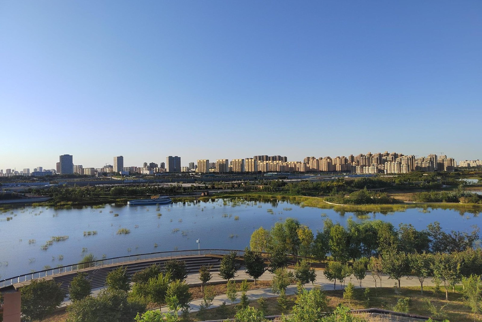
Practicalities first. The green belt runs the whole western edge of town; the boardwalk section is the maintained heart, the levee path is the quiet extension, and all of it is free. Summer evenings belong to the cyclists, spring mornings to the birds, and autumn to anyone with a camera and a free hour.
Practicalities
Beyond the valley, the same 五家渠市 Wǔjiāqú Shì Wujiaqu City keeps more places worth the detour: 青格达湖 Qīnggédá Hú Qinggeda Lake for the bird water, 将军纪念馆 Jiāngjūn Jìniànguǎn the General Memorial Hall for the red-star hall, 郁金香花园 Yùjīnxiāng Huāyuán the tulip gardens for the May fair, or 蔡家湖田园 Càijiāhú Tiányuán the Caijiahu fields for the cotton horizons – four more doors into the same 五家渠市 Wǔjiāqú Shì Wujiaqu City. Once the valley is walked, our Wujiaqu food map fills the day.
Practicalities
Words and Names
flowcloud would say the Toutun valley is the city’s gentle edge: a working river engineered into wetlands, boardwalks looping through the reed gold, and an evening greenway where the whole town exhales. All checked November 2026.
Getting there: The river belt runs along Wujiaqu’s western edge; taxis reach the levee gates in ten minutes from the center, and the greenway paths link the main bridges. All checked November 2026.