
China’s Last Sunrise: Simuhana Village and the West Frontier First Outpost of Wuqia
西陲落日圆,一身担国门 Xīchuí luòrì yuán, yīshēn dān guómén – The sun sets round on the west frontier; one man carries the nation’s gate
正文:西陲第一哨 Xīchuí Dìyī Shào the West Frontier First Outpost stands beside Simuhana village in the far west of 克孜勒苏柯尔克孜自治州 Kèzīlèsū Kē’ěrkèzī Zìzhìzhōu Kizilsu Kirghiz Autonomous Prefecture – the last settlement in China to see the sun go down, and the doorway to the Irkeshtam border port on the road toward Kyrgyzstan. The geography is simple and startling: from the village the road runs west into red mountain folds, and everything beyond the checkpoint belongs to another country. Travellers come for two hours of frontier light and leave with a stronger sense of the map than any atlas has ever given them.
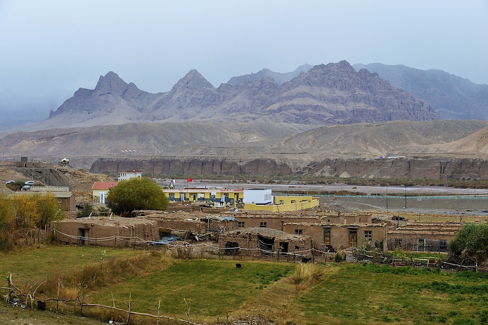
Simuhana itself is a village of low mud-brick courtyards and poplar windbreaks, set on a gravel fan where two valleys meet. Herds of Kyrgyz sheep and a fewcampaign camels work the scrub between the fields; the mountains behind carry the ruined watchtowers of every dynasty that guarded this exit from China. The village’s modesty is the point – this is a working settlement of a few hundred people, not a scenic town, and its dignity lies in exactly that: the everyday business of a Chinese village conducted at the country’s far edge, two time zones of light away from Beijing’s morning.
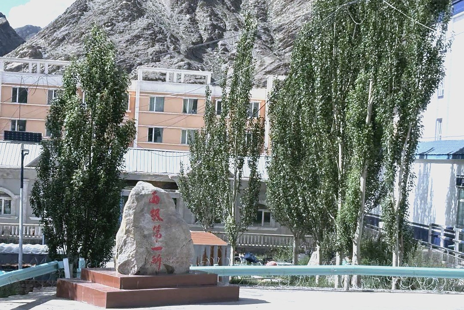
The border experience centres on the stone marker and the outpost buildings at the village edge. The polished granite reads “西陲第一哨” – the West Frontier First Outpost – and visitors queue politely for the classic photograph: hand on stone, red mountains behind, the highway vanishing toward the pass. Military traffic passes constantly; permission around the actual checkpoint buildings is limited, and the armed post next door is not a photo subject. Every traveller should carry their passport or ID for the roadside checks, expect at least two stops each way, and treat the soldiers’ directions as the itinerary’s final word.
The light here has made the village famous among Chinese photographers. Because Simuhana sits so far west, its sunset arrives nearly two hours after the eastern cities’ – the nation’s last light lingers on the red ridgeline while Beijing is already dark – and the village’s morning glow over the Irkeshtam road has closed a thousand gallery essays. The mountain folds burn copper at dusk; the poplars go black; and the silence afterwards is so complete that the highway’s next truck sounds like weather. Overnight stays in village homestays are possible in small numbers and worth arranging ahead through Wuqia contacts.
Practicalities come with the territory. The village sits about one hundred kilometres west of Wuqia county town on the S307, three hours or so from Kashgar including checkpoint formalities; fuel and supplies should be settled in Wuqia or Kashgar, since the village has none worth the name. Border-area travel rules change with the security picture – confirm current access with local authorities before setting out, keep documents on your person, and budget generous time for the return. There is no restaurant; homestay dinners of noodles, flatbread and mutton are arranged with your host family.
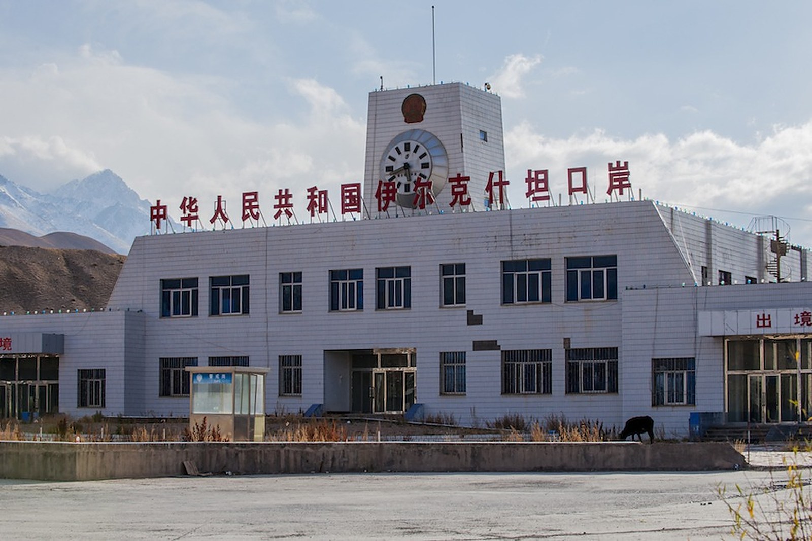
What surprises most visitors is how emotional a line on a map can be. Chinese travellers stand at the marker and take it in turns to be photographed, quietly, like pilgrims; foreign visitors feel something different – the scale of a country whose daily life runs all the way out here, complete with school runs and lamb dinners. The outpost’s name is a rank of honour, and the village wears it without ceremony: the last house, the last lamp, the last dog barking at the last car of the day.
Pair Simuhana with Wuqia’s other frontiers and the region’s character completes itself: yak pastures to the south, the Khunjerab corridor beyond Aktao to the south, and this western gate at the road’s end. Kizilsu has many headline landscapes, but this is its meaning landscape – the place where the province’s maps run out of west, and the light lingers longest before handing the day to another country.
Practicalities
East of the frontier, the same 克孜勒苏柯尔克孜自治州 Kèzīlèsū Kē’ěrkèzī Zìzhìzhōu Kizilsu Kirghiz Autonomous Prefecture keeps more places worth the detour: 阿图什天门 Ātúshí Tiānmén Atush Tianmen for the five-hundred-metre arch, 奥依塔克冰川公园 Àoyītǎkè Bīngchuān Gōngyuán Oytagh Glacier Park for the glacier valley, 白沙湖 Báishā Hú White Sand Lake for the dunes in water, or 阿合奇猎鹰 Āhéqí Lièyīng Aheqi Falconry for the eagle hunters – four more doors into the same 克孜勒苏柯尔克孜自治州 Kèzīlèsū Kē’ěrkèzī Zìzhìzhōu Kizilsu Kirghiz Autonomous Prefecture. Once the outpost is seen, our Kizilsu food map fills the day.
Practicalities
Words and Names
flowcloud would say Simuhana is where the map earns its keep: China’s last sunset burning on red ridges, a stone that says first outpost, and a village that carries the title without raising its voice. All checked November 2026.
Getting there: Simuhana sits near the Irkeshtam port about 100 kilometres west of Ulugqat (Wuqia) county town on the S307, three hours or so from Kashgar with the border-road checkpoints in between. Bring your ID for every stop, fill the tank in Ulugqat, and confirm same-day return with the driver – village lodging is limited to a few homestays. All checked November 2026.