
The mountain is not a peak so much as a wall. 雪峰山 Xuěfēng Shān runs a hundred and eighty kilometres north to south across western Hunan, separating the 沅水 Yuánshuǐ basin from the 资水 Zīshuǐ, and it is the second step of China’s staircase — the edge where the Yunnan-Guizhou plateau drops towards the lake plain. Its highest point, 苏宝顶 Sūbǎodǐng, is 1,934 metres, in 洪江市 Hóngjiāngshì; the ridgeline averages around 1,150 metres and the main pass through it is still a road with more switchbacks than hairpins. Weather arrives from the south-west and stops here. On one side of the ridge it rains, on the other side it does not, and the local expression for the mountain is 雪峰天险 Xuěfēng tiānxiǎn, the natural fortress of Xuefeng.
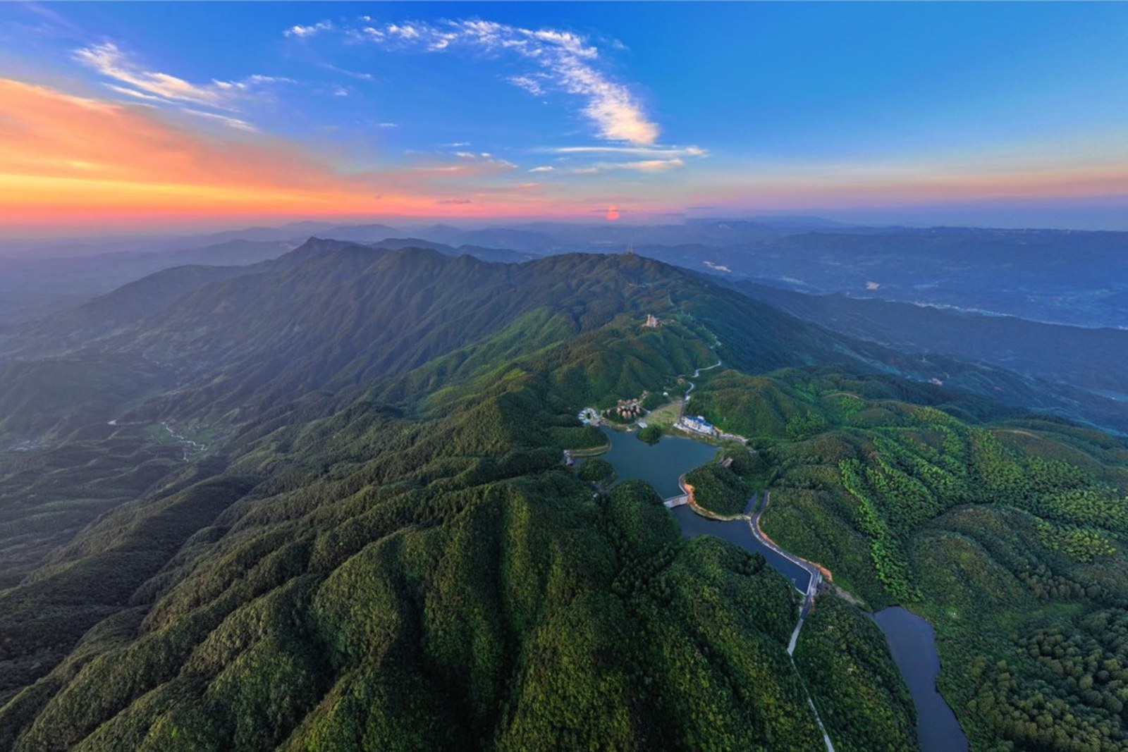
The upper mountain is a 国家森林公园 guójiā sēnlín gōngyuán, a national forest park of about 4,000 hectares, with old-growth secondary forest, high-altitude lakes, alpine meadow, cloud sea at dawn, rime ice in winter and a wind farm of some consequence strung along the summit ridge. Its vegetation is unusual for the latitude: ninety-odd families of woody plants with more than seven hundred species, including 银杏 yínxìng, ginkgo, and 南方红豆杉 nánfāng hóngdòushān, the southern yew. It is one of the global biodiversity hotspots and it sheltered 袁隆平 Yuán Lóngpíng while he worked out hybrid rice in the 1960s and 1970s at the agricultural school at 安江 Ānjiāng, at the foot of the mountain — the 安江农校杂交水稻纪念园 Ānjiāng Nóngxiào Zájiāo Shuǐdào Jìniànyuán is still there.
The mountain’s reputation, though, is for one spring. From 9 April to 7 June 1945, the Japanese army mounted its last major offensive of the war in China, with the objective of taking the 芷江 Zhǐjiāng airfield and forcing a route to Chongqing. The Chinese army, with air support from the Chinese-American Composite Wing, met them in the 雪峰山会战 Xuěfēng Shān Huìzhàn, the battle of Xuefeng Mountain, inside the passes. The fighting at 龙潭 Lóngtán and 洞口 Dòngkǒu went on for two months; Japanese casualties are given as some 28,000; and the offensive collapsed. It was the last general engagement of the war on the Chinese front, and it ended eight weeks before the delegation landed at Zhijiang. There are trenches, bunkers, a hospital cave and pillboxes still visible in the forest above 枳木界 Zhǐmù Jiè, and the victory is the reason the mountain is called, in the local phrasing, the heroic mountain.
Practicalities
Tickets. The forest park is ticketed at about ¥50–80 depending on season and route. The 雪峰山索道 Xuěfēng Shān suǒdào, the cable car from 溆浦 Xùpǔ side, is separate: ¥88 one way, ¥168 return for adults.
Opening hours. Park gates about 08:00–17:30; the cable car runs 09:30–17:30. Sunrise on 苏宝顶 Sūbǎodǐng requires being inside the park before the gate opens, which means staying on the mountain.
Closing day. Open daily; the cable car closes in high wind and during maintenance, which happens in winter.
Getting there. 怀化南站 Huáihuà Nán Zhàn is about 65 kilometres away; 芷江机场 Zhǐjiāng Jīchǎng is about 85. The park entrance is off the 320 national road and the 沪昆 expressway runs along the southern flank. There is a train station at 安江 Ānjiāng on the 沪昆 line, and the cable car base at 油垅村 Yóulǒng Cūn, 北斗溪镇 Běidǒuxī Zhèn, 溆浦县 Xùpǔ Xiàn.
What to Look For
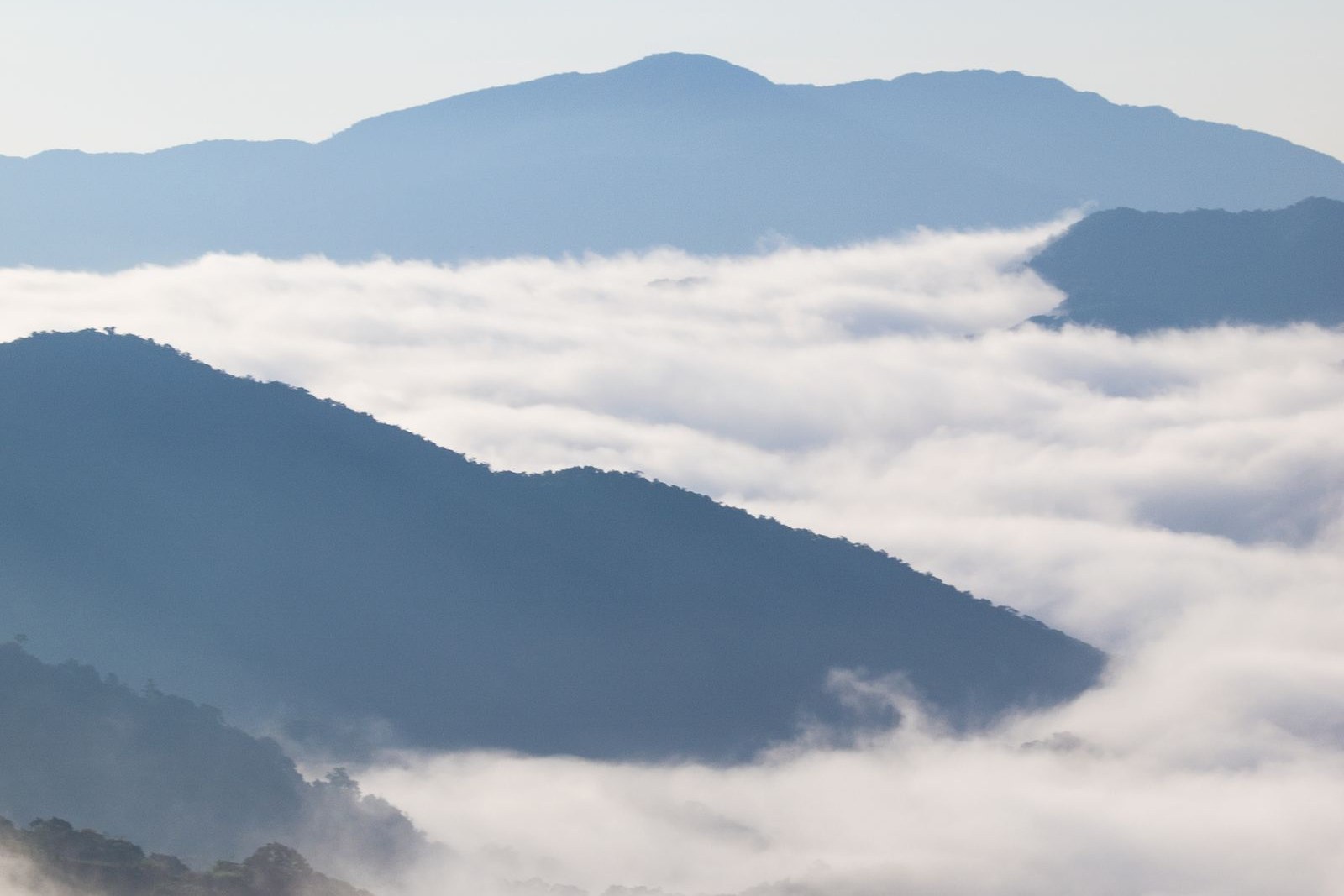
The cloud sea at dawn. The speciality of the mountain: fog fills the valleys from about four in the afternoon and stays until nine, and from the ridge above it, it looks like water. Any of the summit viewpoints will do; 苏宝顶 Sūbǎodǐng is the highest.
The high-altitude lakes. 天池 Tiānchí and 瑶池 Yáochí are alpine wetlands, unusual at this latitude, and the water is drinkable by local account and by the standards of anyone who has tasted Hunan tap water.
The wind farm. About sixty turbines along the ridge, put up in 2013, and the largest high-altitude wind installation in central China. Whether they improve the view is a matter of taste; they are certainly spectacular at dusk.
The war sites. The 枳木界 Zhǐmù Jiè sector retains trenches, covered positions and a hospital cave. There is no interpretation in English and the path is rough; ask at the park gate.
Getting Around
A car is close to essential. The park is 40 kilometres north to south and 8 east to west, the roads are single-track in places, and the summit is a long drive from the gate; the cable car from 溆浦 Xùpǔ is the alternative for people without one. Two days is right: one for the drive and the ridge, one for a walk down into the 岩鹰洞 Yányīngdòng gorge or the 老栗山 Lǎolì Shān forest, and one early morning for the cloud sea. Bring a jacket in any season, because the temperature at 1,900 metres is not the temperature in 怀化 Huáihuà, and expect the weather to change sides without warning.
flowcloud would say that a mountain which stopped an army, sheltered the man who fed a billion people, and then got covered in wind turbines on the same ridge is a fairly complete summary of the last eighty years of China, and that the cloud arriving every afternoon at four is the only thing on it that has not changed.
Getting there: 雪峰山 (Xuěfēng Shān), 洪江市 (Hóngjiāngshì) and 溆浦县 (Xùpǔ Xiàn), 怀化市 (Huáihuàshì), 湖南 (Húnán). Park tickets ¥50–80; 苏宝顶 (Sūbǎodǐng) summit at 1,934 metres. Cable car ¥88 one way, ¥168 return, from 油垅村 (Yóulǒng Cūn), 溆浦县 (Xùpǔ Xiàn). About 65 kilometres from 怀化南站 (Huáihuà Nán Zhàn). Stay on the mountain for the dawn cloud sea, bring a jacket, and allow two days with a car.